By Jeff Blakley
On March 25, 1904, the Miami Metropolis reprinted an essay that was written by an unidentified person for the Fernandina Star, a newspaper published in Fernandina, Nassau County, Florida. Entitled Perrine Land Grant, An Interesting Writeup of the Famous Cutler Region, the piece offered some interesting observations about agricultural activities taking place in that area. This land, as most know, was given to Dr. Henry Perrine in 1838, who was killed on Indian Key in 1840.
In the article, the writer stated that tomato growers Thomas J. Peters and his brother William I. Peters owned 325 acres, the Easterling Bros. owned 200 and Joe and James Griffin owned 25. There were also fruit growers: Lucy C. Carnegie, Dr. J. D. Palmer and James A. Smith had small groves and Fred Kidder, “a large rice planter in North Carolina, has purchased 300 acres of prairie land and intends to put out 50 acres in grapefruit next winter and has eight acres in tomatoes now. If they are a success, he will plant 50 acres in tomatoes next year.”1
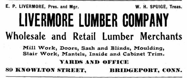
Frederic Kidder was born on January 12, 1847 in Wilmington, North Carolina, the son of Edward and Ann Kidder.2 His father, Edward W. Kidder, was a very wealthy wholesale lumber dealer, having real estate assets of $127,000 and a personal estate worth $246,000 in 1870. In 2023, those amounts are $2.9 and $5.8 million.3 Edward, who was born in New Hampshire,4 sent his sons Gilbert and Frederic to Harvard College, from which Frederic graduated in 1870.5
On February 2, 1882,6 Kidder purchased two rice plantations: Lilliput and Kendal, located on the west bank of the Cape Fear River just north of Southport.7 The biographical entry in the Harvard College publication for Kidder, published in 1888, was short: “Since graduation has been engaged in the lumber-business and rice-planting at Wilmington, N. C. (No Report)”8
The Kidder family was in the upper class and members of the family were frequently mentioned in the period of 1870 to 1910 in the Wilmington newspapers. In February of 1890, Kidder and Dr. George G. Thomas went to Cuba for unspecified reasons.9 There was no mention of any connection between Kidder and Florida until this, in The Wilmington Morning Star in 1903: “Mr. H. M. Flagler is the guest of Mr. Fred Kidder at Kendall plantation.”10
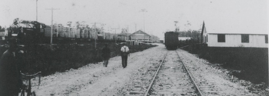
Work on the Cutler Extension of Flagler’s F.E.C. Railway started on the south bank of the Miami River in January of 1903. By October, the railroad tracks had been placed as far south as S.W. 136th St., south of the area now known as Kendall.11 The rails reached Perrine, south of Kendall, in late November of 1903.12
The first mention of Frederic Kidder in the Miami newspapers occurred on October 30, 1903, just five months after he and Flagler had discussed business, when Dr. S. H. Richmond reported that he had sold 200 acres of prairie and 40 acres of pine land to Mr. Kidder, of Wilmington, N. C.13 On May 7, 1904, William E. Raulerson and his wife sold Kidder the east half of lot 5 in block 115 of the town of Cutler for $150.14 15 William and his wife Drucilla were residents of Silver Palm until 1911, when they moved to Micanopy in Alachua County, Florida.16 17
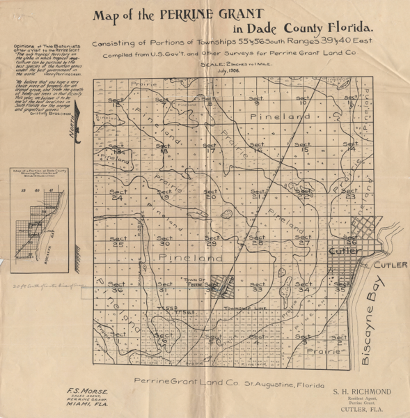
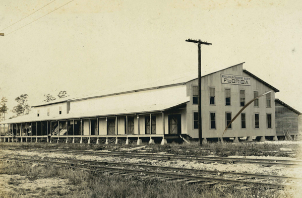
The next mention of Kidder in Dade County came in September of 1904, when the Jacksonville Times-Union reported that J. E. Ingraham (the 3rd V-P of the F.E.C. and an officer of the Perrine Grant Land Co.) said that the Government had reserved land for an “experiment station in section 11 of the Perrine Grant. This tract joins that recently purchased by Fred Kidder and means much for that part of Cutler precinct. The railroad station at that point will be on or near Mr. Kidder’s property and will probably be named Kendal, after his plantation in North Carolina.”18 Section 11, at the northeast corner of the Perrine Grant, is bounded by SW 104th St. on the north, SW 120th St. on the south, SW 77th Ave. on the west and SW 67th Ave. on the east. The Kendal depot was built in late 1904 or early 1905 on the east side of the railroad tracks, now the Busway, at about SW 98th St. to facilitate the shipment of grapefruit and oranges from Kidder’s property and from the packing house of the Flagler Grove, 200 yards away from the depot.19 By early 1911, the County had built a new road, now known as U. S. 1, parallel to the railroad tracks between Flagler Grove and the depot.20 21
About 50% of section 11 was marl prairie subject to flooding in the summer months. It is quite possible that Flagler, whose company was granted tens of thousands of acres of flood-prone lands by Florida’s Internal Improvement Fund, discussed rice cultivation with Frederic Kidder in 1903. In 1906, Dr. Samuel H. Richmond and John S. Frederick spent “two weeks in surveying a body of land in the Perrine grant now owned by a northern company for the purpose of experimenting in the culture of rice in that section. They have made their headquarters at camp Wonder, on the tract, where the land is of a marshy nature and the nearest fresh water three miles away. The land is to be ditched and drained and a thorough test of its rice growing qualities given by its northern owners.”22 In September of 1909, The Florida East Coast Homeseeker, a Flagler publication, reported that Mr. B. S. Hunter, of Black Point, planted his rice crop on June 8th and harvested it on September 23rd.23
Tomatoes were king, however, and the needs of that crop for dry land drove the many drainage projects conducted in the first decade of the 20th century. After the threat of tomato crops being destroyed by flooding was greatly reduced, the possibility that rice could be grown as a profitable crop in Dade County vanished.
Kidder had purchased his property prior to September of 1904 and likely did so after discussing business opportunities with Mr. Flagler in early 1903.24 By October of 1904, Kidder had hired a force of men to clear and plant 35 acres of his new property in grapefruit trees.25 By November, he had purchased more land and had “built three houses and a fine barn on the premises.”26 During this period of time, he was working with H. T. Carter and John J. Hinson27 and by October of 1905, he had a grapefruit grove of over 100 acres at Kendale Station.28
John J. Hinson, who came to Dade County in 1891 before Miami was incorporated,29 may have worked for John Sewell and John S. Frederick in laying out the Town of Miami in 189630 and was the foreman of a gang of men building roads south of the Miami River.31 In December of 1902, his payroll amounted to $774.11, which was paid for by Dade County in January of 1903.32 In 1903, he worked as a foreman on the Cutler Extension.33 In 1904, he went to work for the Flagler interests as the foreman for the Flagler Grove, which was established on 80 acres in the SW 1/4 of 2-55-40, a job he held until the property was sold to George E. Merrick in 1920.34 The Flagler Grove was on the north side of SW 104 St. and adjacent to Kidder’s property, which was on the south side of S.W. 104th St. east of U. S. 1. In 18 months, Hinson claimed to have cleared and planted the acreage in grapefruit trees.35 In 1906, Dr. S. H. Richmond sold Hinson twenty acres “at Kenday (sic – Kendal) near the famous Kidder grove.”36
Jean Taylor, in her book The Villages of South Dade, wrote that Kendall was named for Henry John Boughton Kendall,37 who managed the holdings of Sir Edward James Reed in South Dade County. Reed owned millions of acres of land in Florida in the late 19th century. Professional genealogists are very familiar with how amateur family historians, lacking documentation to prove their assertions, link their surname to that of someone famous with the same surname. Frederic Kidder was in the Kendal area for no more than 3 years and his presence was quickly forgotten. Kendal Station was named after Kidder’s Kendal Plantation in Brunswick County, NC, not for Henry J. B. Kendall.
The last mention of Frederic Kidder in the Miami newspapers came in June of 1906, when a small parcel he owned in section 26-55-40, in the Town of Cutler, was included in a list of owners of parcels who were delinquent in paying their property taxes. That list was based on bills issued in 1905.38 Kidder, who had battled rheumatic ailments in his younger years,39 may have sold his properties and gone back to North Carolina. He died in a sanitarium in Litchfield, CT on October 27, 1908 and is buried in the family plot in the Oakdale Cemetery in Wilmington.
Kidder’s Florida properties were not listed in the probate papers for his estate. How his properties in South Dade were disposed of will have to be the project for another historian. The key to solving that puzzle will be found in an abstract of title to a property located in 11-55-40, if any still exist.
__________________________________________________________________